


Tag: tfl

NFC contactless payments on London bus journeys hit one million
Over one million journey on London buses have now been payed for using contactless NFC payment systems, Transport for London have today revealed. The scheme, which launched four months ago and allows commuters to pay for single journeys by tapping…

London buses now accept NFC contactless payments
London buses have been upgraded to accept contactless fare payments from NFC-enabled smartphones and credit cards as of today, alongside regular cash and Oyster Card fares. All 8,500 of London's buses will have the new systems introduced today, though the…

Google Maps helps London tourists understand that the Tube map is not geographically accurate
Google Maps will now offer live transport updates for London travellers, helping them make better transport choices in our fair capital. In addition to directing people to the nearest Tube stop using GPS, Google Maps will also help people…
120 Wi-Fi hotpsots headed to London's tube network
London's Underground tube network is to get a series of Wi-Fi hotspots in time for next year's Olympic Games, it has been revealed today. 120 hotspots will be coming to the capital's tube stations, with the first 16 coming from…

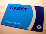
Oyster card may face chop as Tube plans credit card ticket system
(Guest post from Shiny Shiny) The Oyster card was a small revolution in ticket payments when it was launched less than a decade ago, but it seems it may soon become obsolete. Transport for London has confirmed that by the…

Plans for mobile reception on the tube abandoned
Do you remember March 2007? What stands out in your mind about it? If the answer to that question is "why, that's the month TfL announced they'd be trialling mobile phone reception on the underground of course", then prepare to be disappointed.
Two years later, they've decided it's not going to happen. Quite why it took so long is anybody's guess, but the reasoning can be helpfully pinned onto everyone's favourite excuse: the perilous economy. A TfL spokesman explained: "While it is technically possible to deploy mobile phone and data wireless solutions on the deep level Underground tunnels and stations, the unique nature and environment of the Tube mean that project costs would be prohibitively high at this time."

Google adds tube map to Google Maps
Google Maps launched its new ‘Transit’ section of Google Maps this morning, which focuses on public transport. Wonderfully, included in the update is a tube map that you can turn on and off on the display – immensely useful for planning ya route across the capital.
Be aware though – because it’s tied to real geographical locations, it might be a bit confusing, and not as intuitive as using the regular tube map. On the other hand, you might find out something useful, like how close Lancaster Gate (on the Central Line) is to Paddington, or Canon Street to Bank, saving you some trouble, and going miles out of your way to change tubes.
If you’ve got a local metro/tube/underground system of some sort, is it shown on Google’s new layer? Let us know in the comments. Now… if only Google would release street view in the UK…
Google Maps UK (via TechCrunch)
Related posts: Google Earth maps Ancient Rome, hope to catch up to modern Rome within the next 2000 years | Google goes mega-high-resolution on Google Maps with the GeoEye-1 satellite

Mystery glitch wipes tens of thousands of Oyster cards
London transport narrowly avoided a descent into CHAOS this weekend after many widely used public transport smart cards, know as Oyster cards, were corrupted when swiped at ticket gates. Anyone who used their Oyster card between 0530 and 0930 last Saturday is thought to have been affected.

Londoners to use Oyster-enabled Nokia handsets to pay for journeys
 Londoners are already revelling in the new-found freedom their Barclaycards can offer, with its fast-cash payments and Oyster-power, but what about us
 fortunate unfortunate types who aren’t actually signed up with Barclays Bank?
Well, we’ve all got mobile phones, right? How about paying for train journeys using those? According to The…

London Underground to trial in-train mobile phone service
London Underground has announced that it is to begin a six-month mobile phone trial on trains and platforms on the Waterloo & City Line. Though it's not due to start until at least April 2008, the trial will provide mobile…